TGO 2021
After the cancellation of the TGO 2020 walk, due to Covid 19, there was a worry that 2021 may have to be cancelled as well. Thankfully it became clear that it could go ahead as long as we followed the Government guide lines. Big thanks here to Ali, Sue and their loyal team of helpers who once again brought it all together, an incredible effort!
I hadn't started the 2019 TGO as I dislocated a rib on the Shetland to Aberdeen ferry on the way to the Start, so I was keen to get on this one.
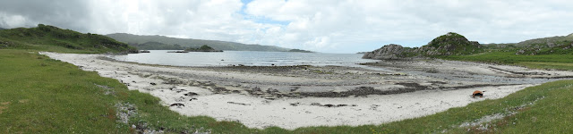
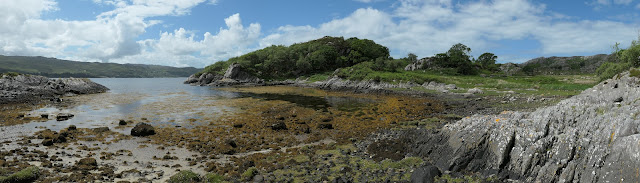
I had chosen Lochailort as my start point as I wanted to visit the deserted crofting community of the Ardinish peninsula.
I left Shetland by ferry on Tuesday the 16th of June, arriving in Aberdeen on Wednesday morning. I travelled by train to inverness, then Bus to Fort William. From Fort William I took the train to Lochailort. I had booked in to the Inn there for 2 nights. I had a nice meal there that night and a big breakfast in the morning. That set me up for a walk on Thursday out to the Peanmeanach and Glasnacardoch ruins.


The weather was variable, sunny to start with some showers later.
I discovered that after less than 200 miles of use, my Roclite Inov8 400GTX boots were no longer waterproof, but my Berghaus trousers and Rab Jacket were sound. I followed a rough path out to the old settlements. It was a beautiful walk and well worth the effort. the old Settlements were in a stunning location.
the round trip was 12.4 miles with 2317 feet of ascent.
All my walks were recorded on Viewranger.

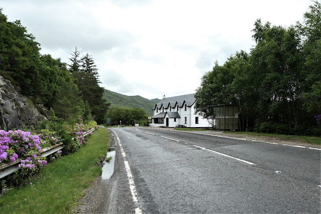
Looking back at the Lochailort Inn
I get off the road and start following the old path
After about 6 miles I reach the Old settlement.
The one remaining roofed croft at Peanmeanach used to be a Bothy, it is now a private croft that can be rented out,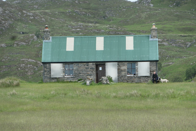


Later back at the Lochailort Inn, I see
Mike and Colin arrive From the train.

On day one of the Challenge proper, I set of towards Oban Bothy
11.4 Miles 2313ft Ascent

I set off from the Inn and catch up with Mike


He breaks a pole just after this photo is taken and sinks to his knees in the bog.
Luckily he is able to tape his walking pole together and carry on.


I get my first glimpse of Loch Morar as I descend Abhainn Taodhail


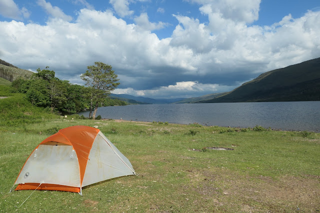
I camp in front of it.
It has been a nice first day, helped initially with the company of Mike, then encouraged by the fine sights and brighter weather. It was wet underfoot and my feet are soaked.
I have an early night as two vertebrae in my middle back is threatening to lock up.
A bit worrying this far from any easy escape route.
I speak briefly to another TGO hiker who arrives 2-3 hours later, but our conversation is cut short as midges descend.

I hear the other Hiker leave, then I take plenty of Ibuprofen and paracetamol and linger at the Bothy, until my back eases a bit. I then head up the beautifully atmospheric Glen Pean.
12.8 Miles 2840ft

Both the small Lochan and Loch Leum an t-sagairt are a test of my head for heights, as I pass them on very steep slopes.
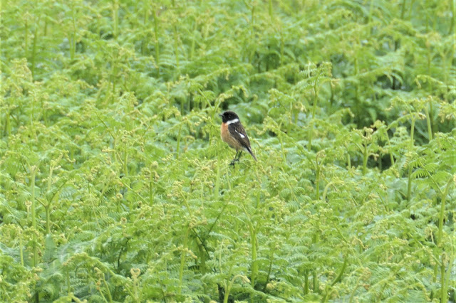
I passed a cliff with about 4 nesting Kestrels


Once I realised my mistake, I decided to carry on rather than turn round as My back wasn't completely pain free and the easier route may be more sensible.
Photo looking back at the road I had just come and across at the route I had intended to take up the steep slope on the left of the V shaped valley.

Just after this photo I had the Bonus of bumping in to Kirstin, and we walked a couple of miles together until she made camp.
I went on another couple of miles in an attempt to make the next day shorter, as there was rain Forecast.

Later I spoke to Colin who camped the other side of a small stream

17.6 Miles 1930ft

I stop to pay my respects at the Commando memorial.

I phone the Spean Bridge Hotel on the off chance they have a room.
I get lucky, and also get an excellent Bar supper of Fish and Chips and a Breakfast to set me up for the day.
After a comfortable night at the Hotel, where I wash up my Gear and get everything dried out, I set off in better Weather16m 2940ft

I get a brief sighting of a Red Squirrel


That's Scottish for "Perrie"


It swells and is tight to bend, but Lucky really, as I nearly fell quite a few metres into the burn.
Although I have camped at Creaguaineach Lodge before, my Vetter Martin Banfield, suggested that I should camp further on, as it has been reported as a tick zone.


In the morning a deer passes my tent


I've been here before and it is always a welcoming stop.


I should have gone up the next hill then down the ridge. But made the poorer choice of heading down at the Bealach. This was a much rougher and wetter route, which I would not recommend.


14.2 Miles 2357ft
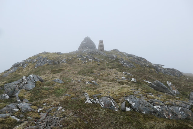
Today was a wet cloudy day so there weren't many photo's taken


Reaching the TRIG pillar and cairn on Beinn Mholach.


14.8 Miles 961 ft


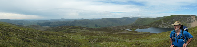
The weather and clouds close in as I reach Loch Nan Euan. Gulls are nesting where I would Like to Camp so I have to pick a poorer spot at the North Side of The Loch to avoid disturbing them, worried the parents may desert their chick.
In the morning A cold wind and sleety rain is whipping over the Loch. Visibility is very poor. I had hoped to follow the ridge to the ski centre. I would have been doing it for the view, as I am not really a Munro Bagger (Not practical coming from Shetland) So I take my Foul Weather Alternative route.
18.8 Miles 1600ft


The weather is great lower down, so I feel that I have made the right choice. I join the Cateran Trail and find it a lovely walk.
Bridge at the Spittal of Glenshee


It was an excellent find that I highly recommend.
19.3 Miles 3685ft


Path into Glen Clova.
The next day I head back into the hills to join my planned route to Glen Clova. I had planned to Camp there, but on the off chance of a room I phone the Clova Hotel from the top of Mayer and strike it lucky. Another night in comfort, no Dehydrated food and some Beer.
Mayer.

The next day's plan is to camp in Glen Lethnot and visit the Brown and White Caterthun Forts the next day.
I am full of walking and reach the Glen very early in the day, so carry on to the Forts.
As I reach them it starts to rain and gets colder. I decide to carry on a bit to find a camp site, but find that after passing the forts the fields are agricultural and due to the time of year already planted. Camping will be difficult, so I head for Brechin and book into a cheap Hotel.
26.3 Miles 3892ft

I pass another Challenger at Loch Brandy


It is a short hop to my finish at Scurdie Ness Light House


Everyone agreed it was different sort of challenge this year due to the International Travel restrictions, the later start date, reduced numbers and fitness levels due to lack of hill time caused by the
Covid epidemic. This probably contributed to the high dropout rate with only 108 of the 125 hikers that started completing the Challenge.
I enjoyed my route and finished a bit earlier than planned due to using a Foul weather alternative route and extending days due to feeling it was too early in the day to stop.
I walked a total of about 203 Miles with 33652 Feet ascent, giving an average of 16.9 Miles/day.
Biggest changes I will make to my gear is I intend to invest in a 1 Person Tent, as there were a few occasions that the footprint of My Copper Spur Big Agnus 2 was too big to allow me to camp, when I wanted, and I would like something that will stand up to poorer weather.
I have been looking at the Tarptent Notch Li over the last year or so and Can't see anything that would suit me better.
I was disappointed with my Boots, a pair of Roclite Inov8 400 GTX. They just weren't up to the job. They let in water at 200 Miles, the uppers suffered from "Pilling" the soles have started to detach from the midsole at @ 500 miles and they have practically no ankle support, which is most noticeable when walking side on along a slope.
On the plus point they were very comfortable when walking on a level surface and they have good grip.
I have bought, used and worn out 3 pairs of Roclite Inov8 G275 since the TGO as they have all the good points of the 400's without the additions that doesn't work, like failed Gortex, and floppy ankle support.
I use them on my road walking where ankle support isn't needed and is just additional unnecessary weight.
For the hills, I have upgraded to Salomon X ultra 4 Gtx Boots and have found them a great improvement.